Local runners dish on the 5 best running routes along the Potomac River
/The Potomac’s recovery is great for clean water and local joggers

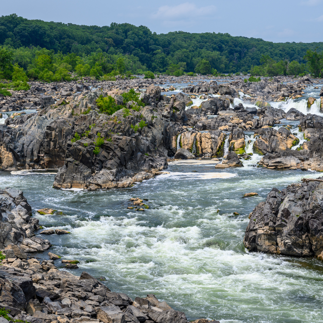
C&O Canal towpath of the Billy Goat Trail
Naturally, the Potomac River is a hub for paddlers – from whitewater kayakers to paddleboarders still getting their river legs.
But the waterway is also a hotspot for runners. Paralleled by a wide variety of trails, from paved paths to more rugged, remote routes, the Potomac River has plenty of options for runners of all experience levels.
Outdoor recreation is on the rise throughout the country, and the Potomac River region is not an exception. When we spend time outside running, hiking, biking, walking, or enjoying other fun activities, we build a lasting relationship with our beautiful streams, forests, and wildlife. Potomac Conservancy is dedicated to restoring the Potomac River to full health because we all run on clean water!
Ready to grab your sneakers? If you’re looking for a distance run on the weekend or a shorter jogging route perfect for weeknights, here are five riverside trails to check out:

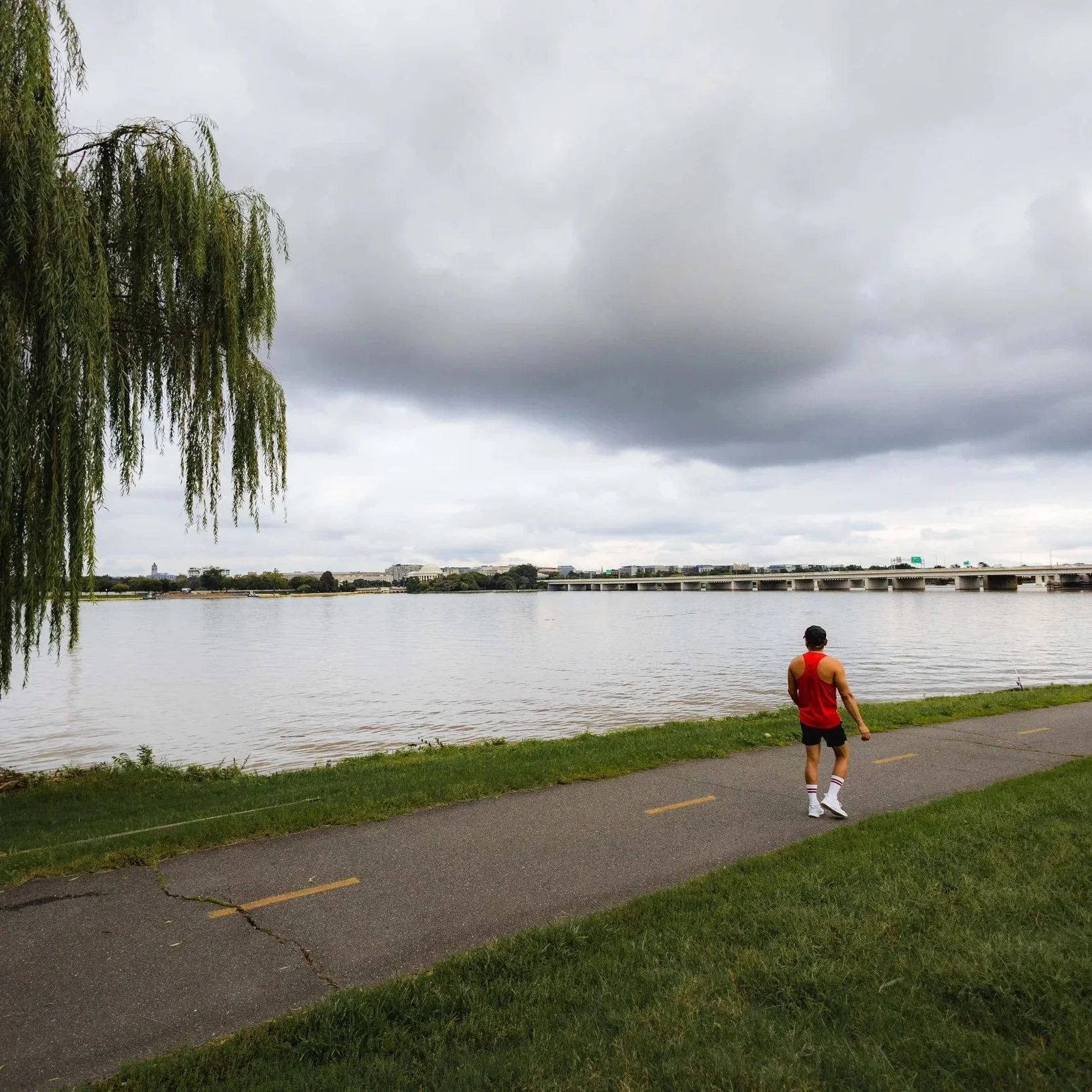
1. Mount Vernon Trail (Virginia)
Length: 18 miles
Type of path: paved
Route: interactive map
How to get there: accessible by metro from Rosslyn, Arlington Cemetery, and Crystal City; parking available at sites along the route including Roosevelt Island, Gravelly Point, Columbia Island, Jones Point Park, and the Belle Haven Picnic Area
Recommender: DC Run Crew
An easily accessible route for runners using public transportation – the Mount Vernon Trail parallels the western bank of the Potomac River in Northern Virginia, extending from Theodore Roosevelt Island to Mount Vernon, George Washington’s historic riverside estate. Fully paved and mostly flat, the trail hugs the riverbank for 18 miles, stringing together a handful of parks, protected areas, and memorials – while offering photogenic views of the capital’s most recognizable monuments. Farther south, the trail passes National Airport – and for runners, the grassy fields at Gravelly Point provide a thrilling vantage point for watching planes arrive and depart.
Beyond the airport, the trail continues through Old Town, Alexandria, offering access to an abundance of restaurants and boutiques, the perfect pit stop for a weekend run! Between Old Town and Mount Vernon, the trail skirts the 485-acre Dyke Marsh Wildlife Preserve, one of largest freshwater tidal wetlands remaining along the Potomac River – and an ideal spot for birdwatching.
Another perk– the parks scattered along the trail offer amenities for runners, and the route is accessible from a handful of metro stations, including Rosslyn, Arlington Cemetery, and Crystal City. The Mount Vernon Trail also connects to a number of other distance trails, including the Custis Trail, Four Mile Run Trail, and the lower portion of the Rock Creek Trail.
The DC Run Crew, a diverse group of fitness enthusiasts who gather for weekly workouts, are big fans, “We love the Mount Vernon Trail. Runners can watch planes land into DCA, and can run into downtown Alexandria for more scenic views and end their run with some great eats. The trail is also pretty flat so really good for beginner runners. In the spring and summer, it’s a great area to picnic or lounge around, people watch, or play sports in the ample field space.”

2. Chesapeake & Ohio Canal (Washington DC, Maryland, West Virginia)
Length: 10 miles
Type of path: crushed gravel
Route: interactive map
How to get there: there are access points, and more than 40 parking areas along the route, including at Fletchers Cove, Carderock, and Great Falls (Maryland)
Recommender: DC Road Runners
Part historical park, part distance trail, part living museum, the Chesapeake & Ohio Canal National Historical Park (also called the C & O Canal) is a multi-state recreation corridor – and a spectacular running route. Paralleling the eastern bank of the Potomac River for 184.5 miles, the trail stretches from Georgetown to Cumberland, in mountainous western Maryland. We recommend starting near lock 7 for some great views! Completed in 1850, for nearly a century, the canal was a vital economic artery, ferrying goods from western towns to the capital.
Today, while there are more than a thousand historic structures remaining along the towpath, the linear park is an oasis for runners. Trees shading the towpath provide an escape from the sun during the spring and summer, while providing habitat for wildlife – and making the route rich especially rich in birdlife! The car-free route also connects to a number of regional trails, including the Capital Crescent Trail, the Potomac Heritage Trail, and the Appalachian Trail. The route is also scattered with trailside accommodations.
The National Park Service (NPS) manages 31 free hiker-biker campsites and five car-accessible campgrounds along the route DC Road Runners recommends the 10 mile stretch from Georgetown to Carderock, “We recommend starting Lock 7 for some great views!”

3. Rock Creek Trail - South (Maryland, Washington DC)
Length: 3.5 miles (southern portion)
Type of path: paved
Route: interactive map
How to get there: accessible from Woodley Park Metro and parking at Thompson Boat Center
Recommender: DC Pynk
Traversing the largest urban park in the National Park System, Rock Creek Trail meanders through eponymous Rock Creek Park for nearly 25 miles – but, one of the most scenic stretches is the southernmost portion. Along the way, the route showcases some of the capital’s most iconic landmarks – and a handful of historic sites. The trail begins paralleling the Potomac near Thompson Boat Center, continuing along the water toward the Lincoln Memorial and serving up views of the Kennedy Center, the Watergate Hotel, and Georgetown’s spire-filled skyline.
DC-Pynk -- a running club for lesbians, queer women, trans and enby runners – hits the southern portion of the Rock Creek Trail every week. “One of our favorite spots on the Potomac is the stretch of the Rock Creek Trail between Georgetown and the Lincoln Memorial. If the run can be timed to arrive there around sunset, the view over the Potomac River, looking at Georgetown is unmatched. Also, take the ramp up to the REACH at Kennedy Center and check out the sculpture garden!”

4. Capital Crescent Trail (Maryland, Washington DC)
Length: 8 miles (a little more than 7 miles paved)
Type of path: paved and mixed surface
Route: interactive map
How to get there: accessible by metro from Bethesda, Silver Spring, and Rosslyn stations
Built along the historic route of the Georgetown Branch of the Baltimore & Ohio Railroad, the Capital Crescent Trail stretches for nearly 11 miles from Georgetown to Bethesda – and about seven miles of the multi-use path are fully paved.
The route was originally used to haul coal, but after nearly a century, the trains stopped running in 1985 – and a year later, the Capital Crescent Trail Coalition was formed in order to turn the former locomotive into a recreational trail. Today, the commuter-friendly route is also a superb option for runners -- with plenty of access points and the opportunity to connect to other local trails.
Heading south from Bethesda, the paved portion of the trail sluices through leafy neighborhoods. South of the reservoir, the trail continues toward the Potomac River, paralleling the Chesapeake and Ohio Canal’s towpath for almost three miles. One of the places to switch between the trails is Fletcher’s Cove, a popular fishing spot since the 1850s – and a pit stop with picnic tables, boat rentals, and a concession stand. A bit further south, the trail ends beneath Key Bridge, near the Washington Canoe Club’s 120-year-old boathouse.
Also called the Georgetown Branch Trail, the northernmost portion of the Capital Crescent Trail is also a wonderful run – although portions of the route include detours for ongoing construction. Leaving Bethesda, the trail heads northeast into Rock Creek Park at Jones Bridge Road in Chevy Chase, just south of the Woodend Nature Sanctuary. In the park, the trail connects to the regional Rock Creek Trail, providing plenty of options for loops or longer runs.

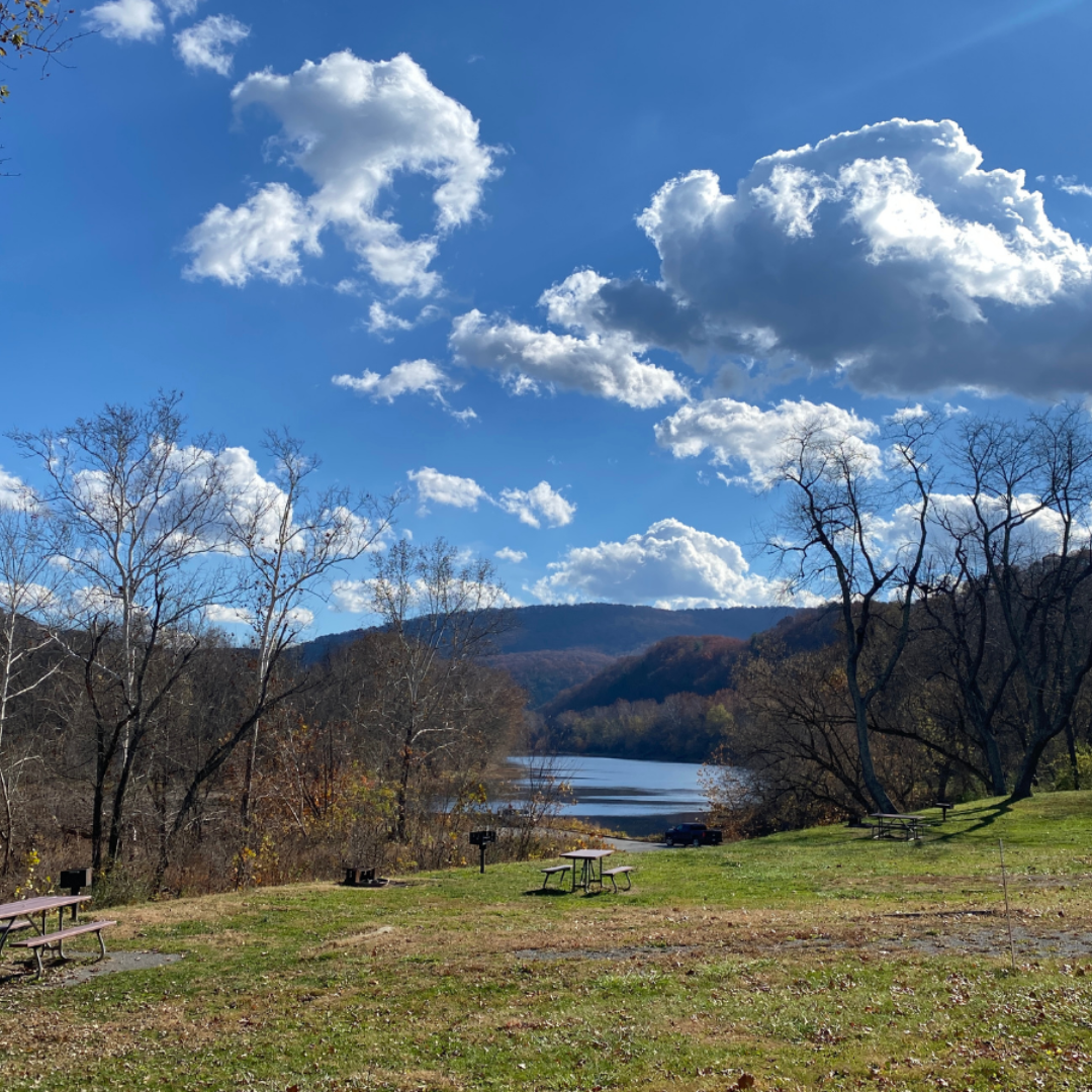
5. Riverbend Park Loop - Potomac Heritage Trail (Maryland, Pennsylvania, Virginia, Washington DC)
Length: 3 miles
Type of path: dirt
Route: interactive map
How to get there: parking available at Riverbend Park in Fairfax
Stretching from the mouth of the Potomac River in southern Maryland to Pennsylvania’s Allegheny Mountains, the Potomac Heritage Trail is a massive trail network, totaling more than 900 miles. While the multi-state route features plenty of mileage to tackle, one of the best stretches for runners is the 2.5 mile portion in Riverbend Park, offering 400 acres of woodlands and meadows, spread along Potomac River in Northern Virginia. Paralleling the river the entire way, Riverbend Park’s mostly flat section of Potomac Heritage Trail extends from the park’s visitor center to Great Falls Park – offering options for an even longer run along the Patowmack Canal Trail, or you use to trail to craft a 3-mile loop through Riverband Park.
🌞 Run safe, run happy, and don’t forget to Leave No Trace! 🥾
Get your hands dirty with Potomac Conservancy!
Looking to give back after your run? Volunteer at an upcoming river cleanup!